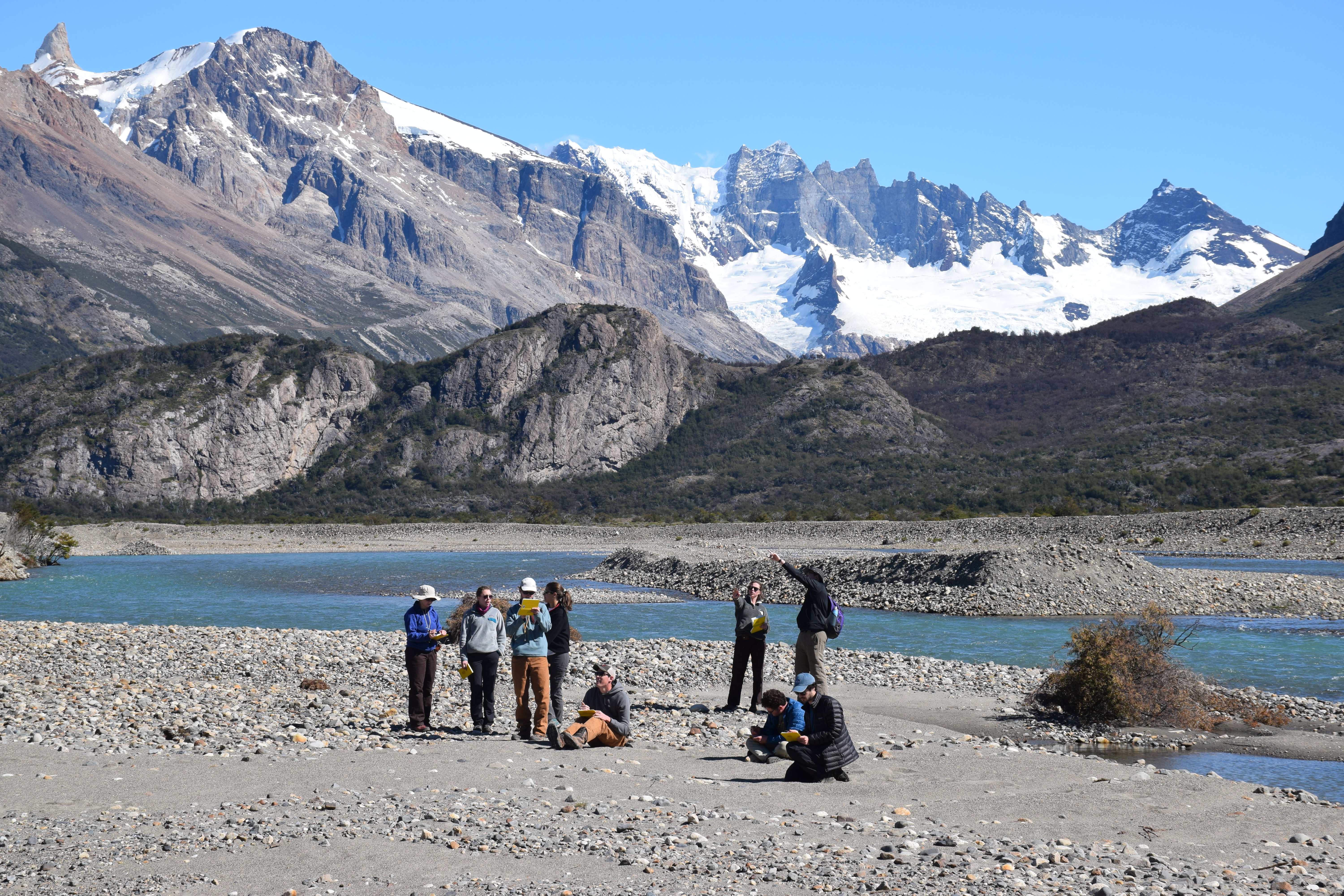
Field work is one of the best parts of majoring in Earth and planetary sciences. In spring 2019, students taking Undergraduate Field Geology had the opportunity to spend their spring break in the field, getting firsthand experience with the geology of the Argentine Patagonia, led by associate professors of Earth and planetary sciences Phil Skemer and Alex Bradley. The class explored the tectonics, sediment accumulations in resulting basins, and geomorphological effects of alpine glaciation in the region. This year's Patagonia expedition had an extra feature: The team was tasked with servicing and collecting data from seismographs used in another WashU research project led by Doug Wiens, Robert S. Brookings Distinguished Professor of Earth and planetary sciences.
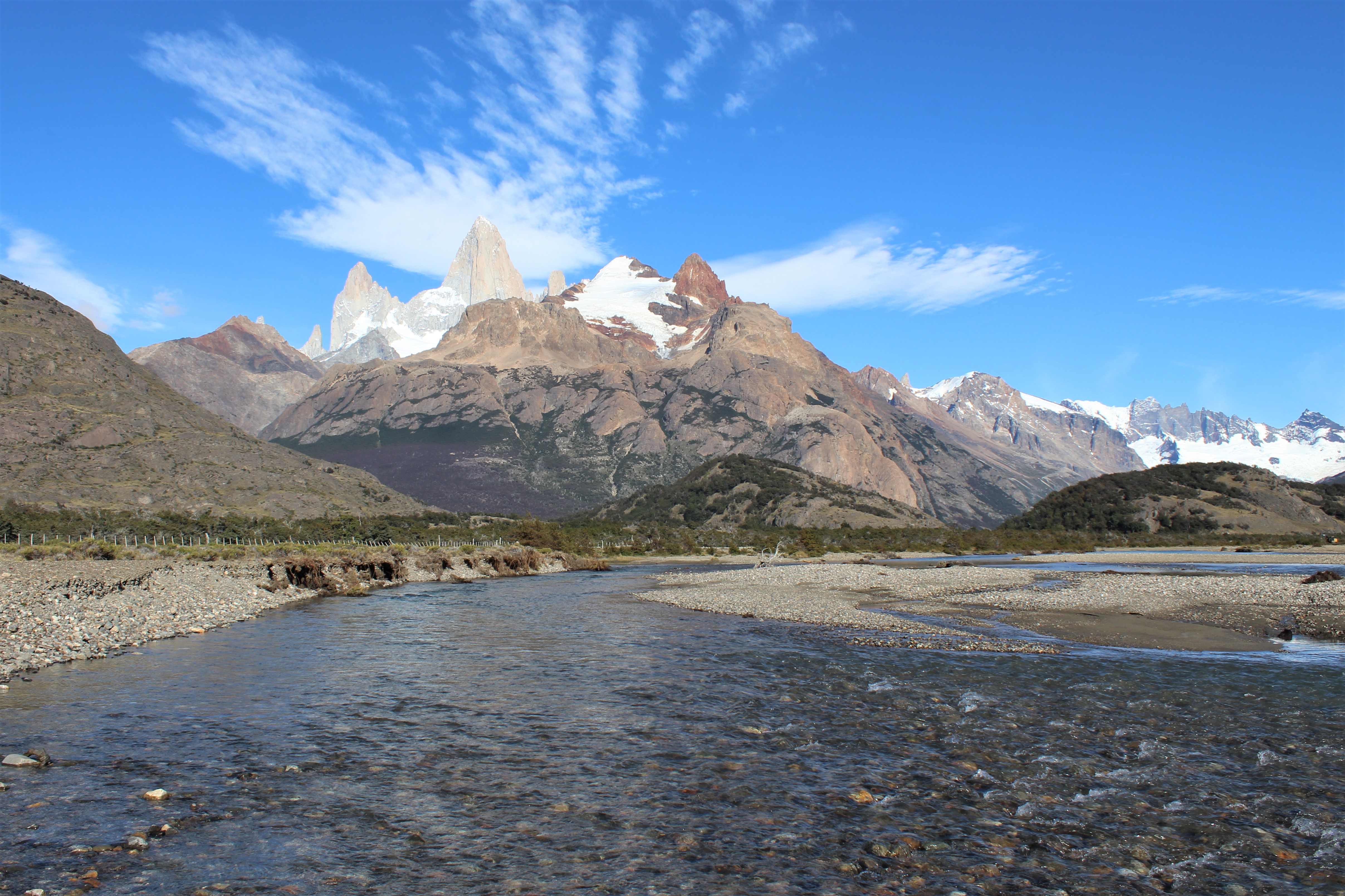
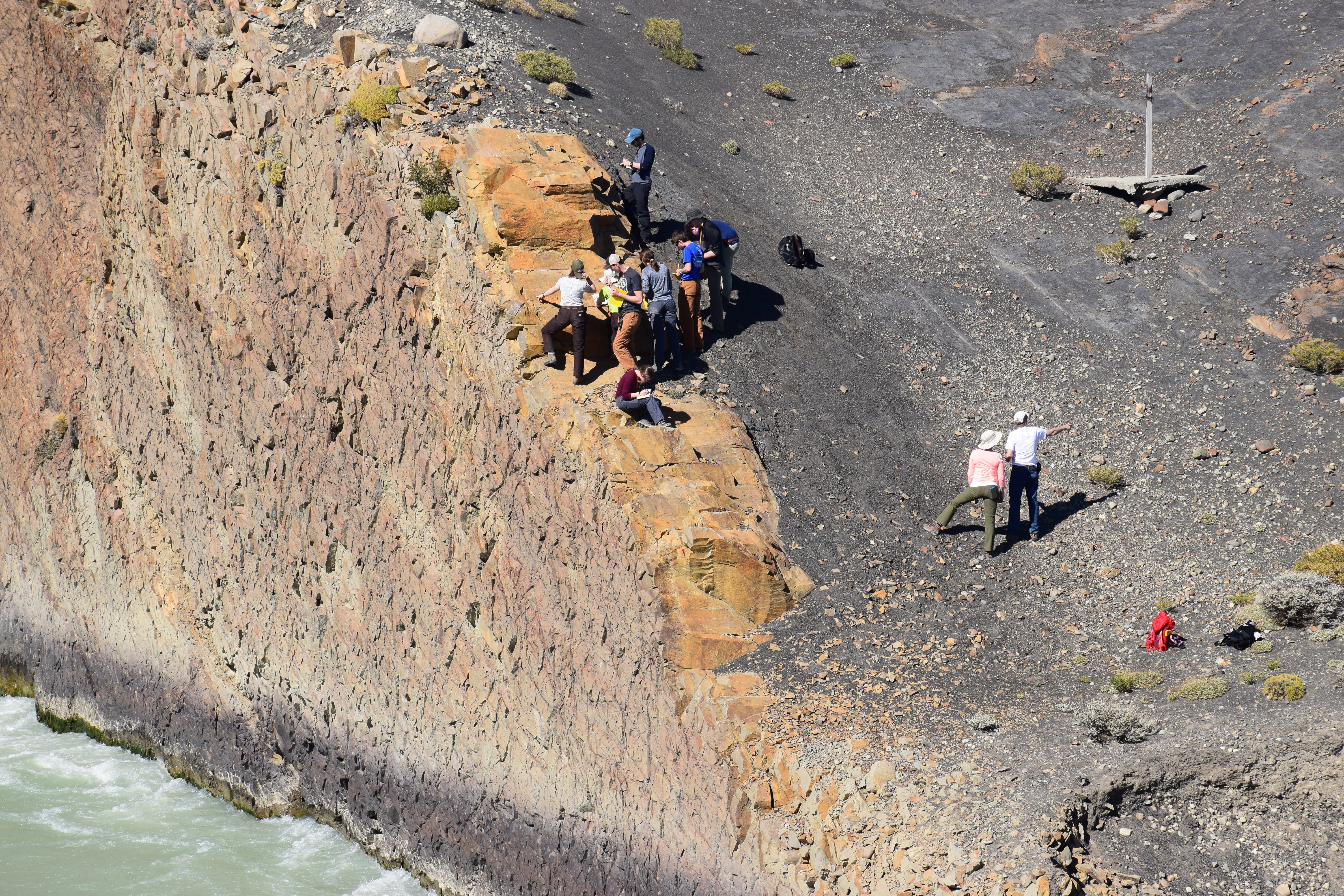
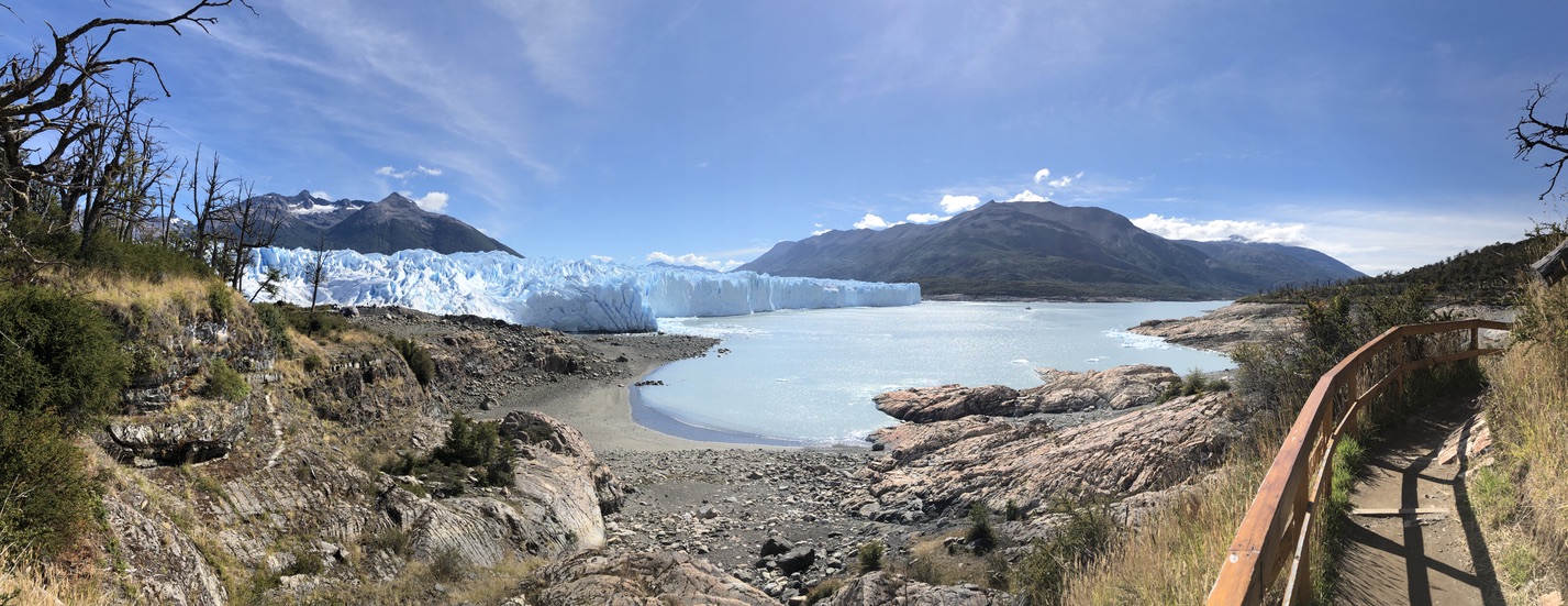
On the trip, students hiked around glacial landforms, analyzing regional and local geology. They spent the first few days of the trip in the village of El Chalten, enjoying spectacular views of Mt. Fitz Roy, studying the history of Andes mountain building, and examining the glacial history of the Southern Patagonian Ice Field. They mapped cross sections of mountains, looking at faults and folds, and sought to answer, "How did these get here?" For the rest of the trip, they were based around the city of El Calafate where they donned crampons (special footwear for hiking on ice) and trekked around the Perito Moreno Glacier, looking at moraines and glacial debris. They also traveled by boat across Lago Argentino to Estancia Christina where they serviced the seismometer there and saw exposures of different geologic units.
When recounting an adventure like this one, a picture is worth far more than a thousand words. Take a look at some of the team's favorite moments in the photos below.
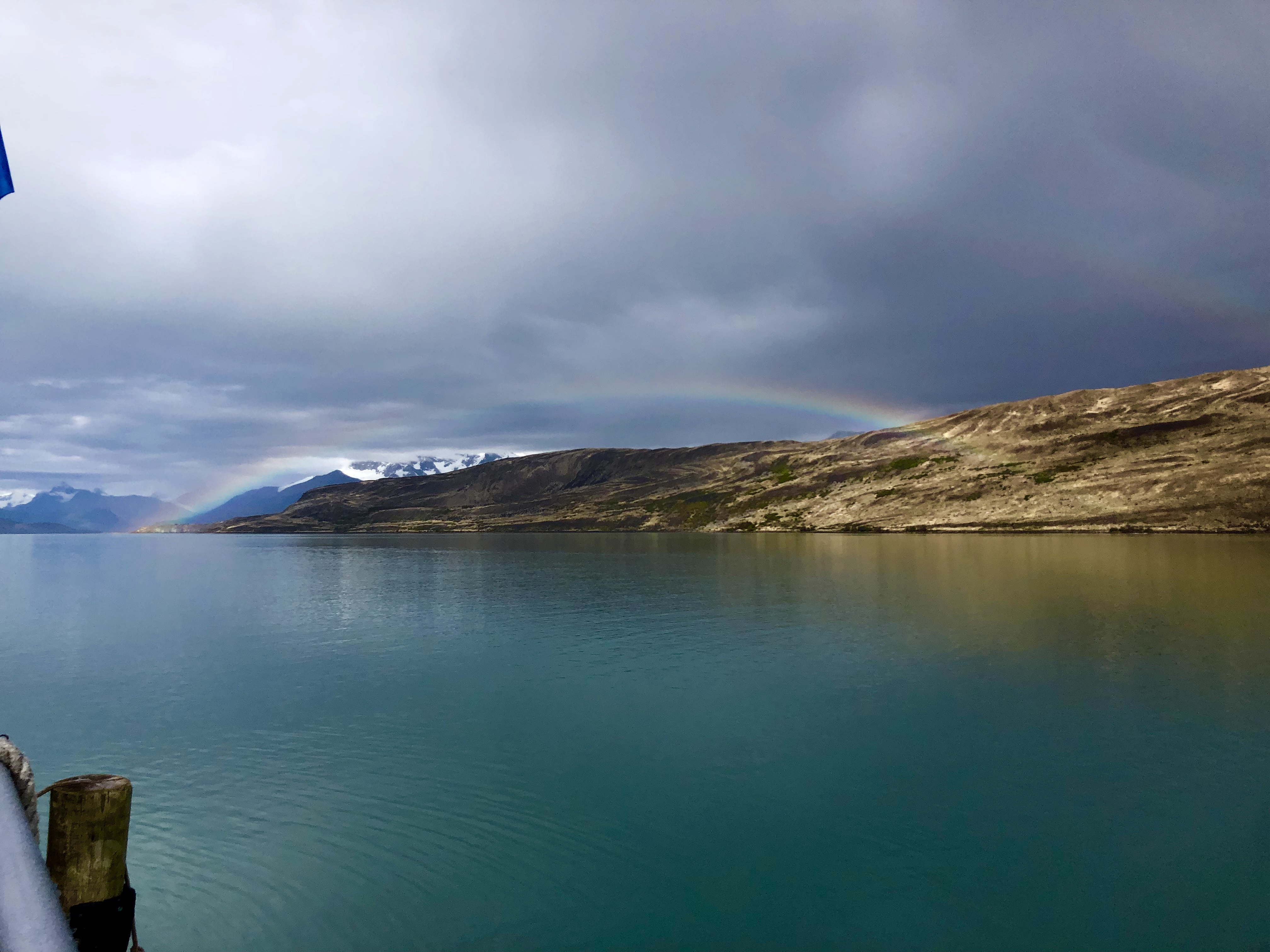
Just north of El Chalten, students work hard to interpret an outcrop. Photo credit: Phil Skemer.Mt. Fitz Roy and surrounding peaks. These monolithic peaks are mostly pyramidal granite formations that have been carved by ice, snow, and wind over millions of years, just like the Matterhorn and Grand Teton. Kilometers of material likely blanketed these structures in the past but have since been eroded away as the entire area experienced uplift from compressional tectonic forces and volcanism. The Southern Patagonian Ice Field is nestled into the mountains just beyond (west of) these peaks. Photo credit: Ben Tiger.A big part of the trip was learning how to step back and see the whole picture, which is an essential part of understanding the geology of a place. Here, Maia Cohen recalled, "We were all getting our noses on the outcrop, trying to determine the type of rock. We were all very confused about why an igneous rock was in that position until Phil told us to back up and go stand on the bridge. When we did, we saw that the igneous rock (light yellow/orange colored one) was a dike that had intruded the dark black shale." Photo credit: Phil Skemer.Hiking on the Perito Moreno Glacier. Perito Moreno is an outlet glacier of the Southern Patagonian Ice Field. Snow accumulates in the ice fields west of these glaciers and compacts into glacial ice over time. Under immense pressures, and with meltwater at its base, ice can flow into valleys far from where it initially accumulated and form these kinds of glaciers. Most outlet glaciers from these ice fields have been actively retreating. Photo credit: Ben Tiger.View from an outlook on a small hidden trail that led back to the starting point for the glacier tour. The class walked on the beach below to reach the glacier, and right behind the trees was where the hike actually took place. The glacier was surrounded on either side by vibrant green forests, which was an unexpected sight next to so much ice. Photo credit: Maia Cohen.Spotted while disembarking the boat from El Calafate to Estancia Christina: a double, or possibly triple, rainbow. An absolutely gorgeous day for fieldwork. Photo credit: Ellie Moreland.